20,345floats searchable
~4,300active right now
2,913BGC floats
587Deep Argo floats
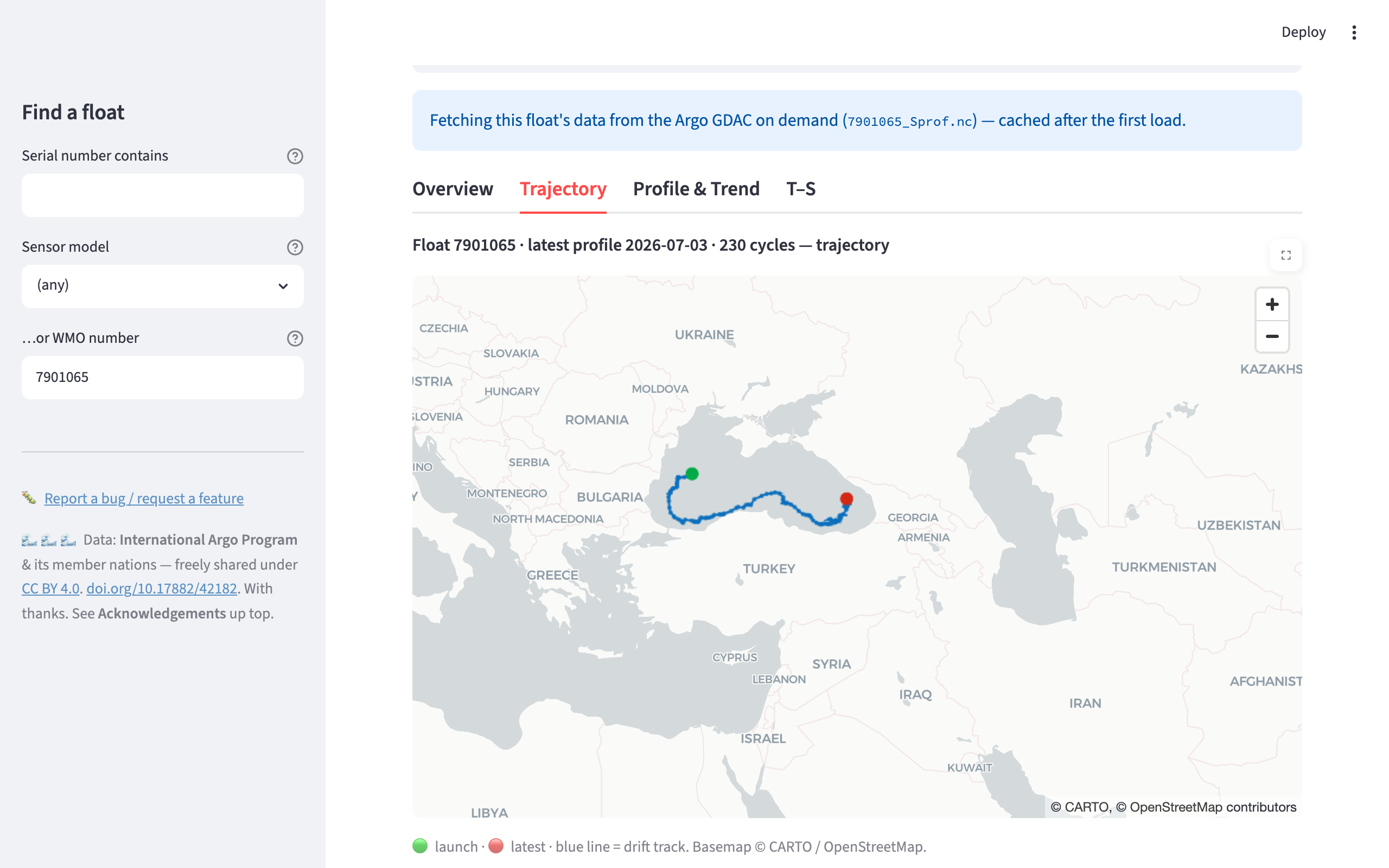
A float's drift track on an interactive basemap, one of six tabbed views (Overview, Trajectory, Profile & Trend, Overlay, T-S, Raw).
Find a float by its CTD serial number, or by sensor model, WMO, or region, and explore the entire Argo array: BGC, core, and Deep Argo (SBE61 6000 m).
A float's drift track on an interactive basemap, one of six tabbed views (Overview, Trajectory, Profile & Trend, Overlay, T-S, Raw).
A fast, free tool for oceanographers and the curious. Find an Argo float by its sensor serial number: enter a CTD serial (SBE41, SBE41CP, SBE61) and see which float it belongs to, every other sensor on board, where it is, and what it has measured, across the whole global Argo program.
Find any float by CTD/sensor serial number, sensor model (e.g. SBE41, SBE61), float type (Core, BGC, Deep), WMO number, or location. A serial search highlights exactly which sensor and serial it matched; click a match to open it.
Biogeochemical (Sprof), physical core (prof), and full-depth Deep Argo floats, including 6000 m SBE61 Deep SOLO, Deep APEX, and Xuanwu profilers.
An interactive trajectory basemap, vertical profiles (real-time, QC-filtered or adjusted), depth-time sections, temperature-salinity diagrams, up to four measurands overlaid on one pressure axis, and per-pressure time series with Sen's slope and Mann-Kendall trend tests.
Pull one cycle or hundreds of raw B-files straight from the GDAC and inspect the intermediate sensor signals (raw fluorescence, backscatter, optode phase) that never reach the synthetic product, then export every level as one CSV.
Potential density σ₀, conservative temperature, mixed-layer depth, and
apparent oxygen utilization, computed on the fly with gsw.
Float profiles are fetched on demand straight from the Argo GDAC when you open a float, with no stale local mirror.
MIT-licensed code, built on freely available Argo data. No login, no cost, for everyone.
Enter a latitude and longitude and a radius, and the tool lists every Argo float whose last known fix falls inside it, nearest first, with the distance in kilometres. It draws them on a map you can click to open any float. No other public Argo tool lets you go from a coordinate to a float's full sensor dossier in one step.
Not sure where to look? 21 region presets jump straight to well-sampled water: the Labrador Sea, Gulf Stream, Sargasso Sea, Station ALOHA off Hawaii, the Kuroshio, Drake Passage, Kerguelen, the Arabian Sea, the Bay of Bengal, the western Mediterranean and more. Every preset was chosen from the live index, so each one always has active floats in it.
Tick Show every active float to map the whole live array at once: roughly 4,300 floats still reporting worldwide, out of the ~20,300 ever deployed. Each dot is colored by type, so you can see at a glance where the BGC floats cluster and where Deep Argo is sampling.
A float counts as active if it has reported a profile in the last 60 days. Argo floats surface roughly every 10 days, so a longer gap almost always means the float has stopped. Every float in the results carries an active or inactive status and its last profile date, which answers a question the raw GDAC index makes surprisingly hard: is this float still alive?
Everything you can see, you can take away. Export any parameter as CSV, a per-pressure time series as CSV, a float's complete profile file as the original NetCDF, or every raw level you pulled as a single CSV carrying every parameter the B-files report plus each one's QC flag, ready to load straight into MATLAB, pandas or R.
Prefer to query it yourself? A free, no-key data API publishes the whole index as Parquet and JSON, so you can look up floats by sensor serial number with DuckDB or pandas over plain HTTP.
The app stores only a compact metadata index for all ~20,000 floats (a few megabytes), so search is instant. When you open a float, its full profile dataset is streamed live from the Argo Global Data Assembly Centre and cached, giving the best of both worlds: complete coverage without hosting hundreds of gigabytes.
https://doi.org/10.17882/42182.
Derived quantities shown here are not official Argo products.
Query the whole array by sensor serial number, model, WMO, region, or type, straight over HTTP with DuckDB or pandas. No key, no rate limit. The serial/sensor lookup is something the GDAC, ERDDAP, and Argovis don't offer.
-- Every 6000 m Deep float (SBE61 CTD), in one query:
SELECT DISTINCT wmo FROM
  'https://vladsimontov.github.io/ArgoFloatData/api/sensors.parquet'
WHERE sensor_model = 'SBE61';